Alto de la Quiebra, Cisneros. Antioquia.
ESPACIO FORESTAL S.A.S.
Forestry consulting and services

Espacio Forestal S.A.S. Is a company formed with the objective of contributing to the development of forestry potential that Colombia has, guiding and accompanying small and large owners, through advisory and related services.
Espacio Forestal S.A.S. Is a service provider, with professionals with extensive experience in the forestry sector, acquired in various companies and regions inside and outside Colombia.
Projects and Cartography
Operations
Legal area

Héctor Enríquez Fuentes
Forestry engineer. Graduated from Universidad de Concepción, Chile.
In Chile, he worked in various areas of the forestry sector, such as the establishment of forest plantations, the control of production in a sawmill and the quality control of wood for exportation. In the industrial area, he has worked on quality control of export products of various kinds, and carried out internal audits of hygiene and safety standards.
In Colombia he served as Chief of Administration and head of cartography department for a forestry project in the department of Córdoba and Antioquia.
In the course of the practice of the profession he has specialized in the area of Geographic Information Systems (G.I.S.) and cartography.
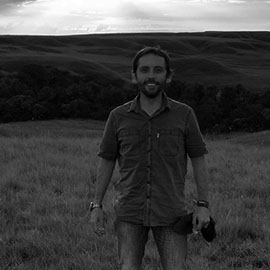
Rodrigo Enríquez Fuentes
Forestry engineer. Graduated from Universidad de Concepción, Chile.
He has held various positions in the forestry area for large companies both in Chile as in Colombia, where stands out the administration of an estate of around 15,000 hectares of plantations in the central zone of Chile, the evaluation, establishment and administration of the operations of a forestry project of 26,000 hectares in the department of Antioquia, Colombia and later the participation in a project of similar scale in the eastern plains of Colombia.
With an experience that dates back to the year 2001, he has specialized in the areas of Soil Management, Forest Nutrition, Establishment and Management of forest plantations and forestry schemes of High Productivity, among others.
He has also specialized in the development and application of technologies for the use of UAV (Unmanned Aerial Vehicle) or DRONE applied to the Forestry, Agricultural and Civil engineering area.

Patricio Aristizábal Valencia
Lawyer. Graduated from the Universidad Pontificia Bolivariana de Colombia.
With more than 25 years of experience in the practice of the profession, he has specialized as legal advisor in agrarian, forestry, labor law and social security law.
WHO WE ARE
WHAT WE DO
Espacio Forestal S.A.S. has a portfolio of services and advice that include:

Legal advice for Studies of Titles and other processes.
Our team has extensive experience in legal processes, such as studies of Titles, processes of correction of area, mutations, disengagement and other associated processes.
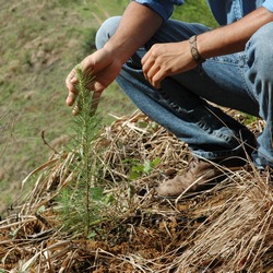
Advice for the establishment of forest plantations
In order to establish a forest plantation, it is fundamental to know the objective that it will be given to your plantation, to identify species to use and many other factors that must be considered when making a good decision. Our company can guide you to achieve your objectives.
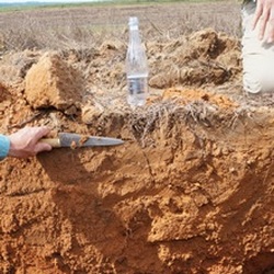
Advice on nutritional issues
The soil is unique and with very particular characteristics, which will greatly condition the type of crop we can establish in it. The soil is also the support, both physical and nutritional, that is given to each crop. For these reasons must be analyzed to identify the constraints that could have and thus improve its potential.
We help you to interpret the corresponding analyzes and to determine the optimal dose for your culture.

Forest Inventories
If you already own a plantation, or require accompaniment when buying a forest or forest plantation, we help you obtain the necessary information to enhance your plantation. Products and volumes of wood are the information required for decision making and the correct valuation of their assets, whether in growth or already developed.
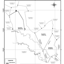
Farm Measurement
For the measurement of farms, GPS are used with high precision, calibrated and with the existing frame of reference, according to the National Geocentric Reference Frame MAGNA - SIRGAS, established by the Agustín Codazzi Geographic Institute. These GPS devices allow accurate measurements in a short time, and in this way, deliver results quickly and reliably, in the dimensions and format that the customer needs.


Mapping consultancy
We update your cartography or if you want to migrate from paper drawings to modern digital systems, our company can guide and accompany you during this process, providing training to the personnel that is required, as it is vital to have reliable and top quality information, for decision making.
We also have Unmanned Aerial Vehicle (UAV) or dron, with which you can get a lot of information in a practical, safe and low cost.
Likewise, through the processing of the information generated with the UAV, it is possible to obtain analysis tools such as level curves, cubic volume of soil, distances, areas and lengths, among others. It is also possible to obtain an orthophotography. Photographic representation of the zone, in which all the elements present the same scale, free of errors and deformations, with the same value of use of a cartographic plane.
GALLERY
CONTACT US
Image obtained from a hexacopter equipped for aerial monitoring.
Helicopter with autonomous piloting system.
Plantation of Pinus tecunumanni in the Nordeste of Antioquia
Digital survey obtained from aerial photographs.
Digital terrain model (DTM) obtained through aerial photographs and field checkpoints.
Aerial image of overflight on the Cauca river.
Vichada, Colombia.


